| Lake Crescent, Olympic NP, Air Quality Webcam, off US 101 @ MP 232  Elevation: 590 ft |
Hurricane Ridge, Olympic NP, 15 miles NE of Mount Olympus, looking SW  Elevation: 5250 ft |
Hurricane Ridge Parking Lot, Olympic NP, 11 miles south of US 101 @ MP 248, looking NE  Elevation: 5250 ft |
New Dungeness Lighthouse, north of US 101 @ MP 265, looking south  Elevation: 20 ft |
New Dungeness Lighthouse, north of US 101 @ MP 265, looking north 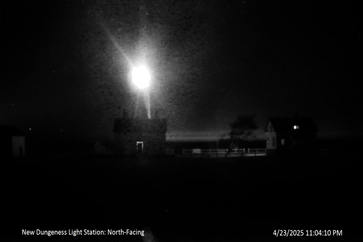 Elevation: 20 ft |
Olympic Rain Shadow Cam in Sequim, north of US 101 @ MP 265, looking north 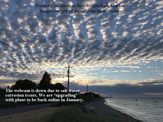 Elevation: 20 ft Image modification time: Sun Jan 28, 2018 17:23:09 |
John Wayne Marina in Sequim, east of US 101 @ MP 267, looking south towards Olympic Mountains  Elevation: 20 ft |
View of the Olympic Mountains, looking southwest from just above Ledgewood Beach on Whidbey Island Elevation: 250 ft |
SR 112 @ Burnt Mt  Elevation: 200 ft |
Heckelville Shed on US 101 @ MP 214  Elevation: 930 ft |
Indian Valley on US 101 @ MP 237.2  Elevation: 380 ft |
NPS Elwha River Restoration Project, Lake Aldwell Delta, north of US 101 @ MP 239 Elevation: 200 ft |
NPS Elwha River Restoration Project, Lower Lake Aldwell, north of US 101 @ MP 239 Elevation: 200 ft |
NPS Elwha River Restoration Project, Lake Mills Delta, south of US 101 @ MP 239 Elevation: 550 ft |
NPS Elwha River Restoration Project, Glines Canyon Dam, south of US 101 @ MP 239 Elevation: 550 ft |
NPS Elwha River Restoration Project, Lower Lake Mills, south of US 101 @ MP 239 Elevation: 550 ft |
NPS Elwha River Restoration Project, Former Lake Mills, south of US 101 @ MP 239 Elevation: 550 ft |
| Port Angeles Airport, 1 mile north of US 101 at MP 245, looking south  Elevation: 300 ft |
Port Angeles Airport, 1 mile north of US 101 at MP 245, looking west  Elevation: 300 ft |
Port Angeles Airport, 1 mile north of US 101 at MP 245, looking NW  Elevation: 300 ft |
Port Angeles Airport, 1 mile north of US 101 at MP 245, looking NE  Elevation: 300 ft |
Port Angeles Harbor View, 2 miles south of US 101 at MP 247, 0.8 miles west of Hurricane Ridge Rd, looking north Elevation: 950 ft |
Port Angeles Webcam, ferry landing off US 101 at MP 248, looking north  Elevation: 50 ft |
Siebert on US 101 @ MP 256  Elevation: 290 ft |
Bell Hill, south of Sequim and US 101 @ MP 265, 180° panoramic view looking south across Happy Valley towards Olympic Mountains  Elevation: 1100 ft (link to full-size 2560x960 image) |
Sequim Valley Airport, off US 101 @ MP 260, looking south  Elevation: 150 ft |
Diamond Point on US 101 @ MP 275  Elevation: 320 ft |
Port Townsend Airport, SR 20 @ MP 7, looking SSW  Elevation: 110 ft |
Port Townsend Airport, SR 20 @ MP 7, looking west  Elevation: 110 ft |
Port Townsend Airport, SR 20 @ MP 7, looking north  Elevation: 110 ft |
Port Townsend Airport, SR 20 @ MP 7, looking east  Elevation: 110 ft |
Jefferson County Courthouse, Port Townsend, SR 20 @ MP 12, looking SW towards Olympic Mtns Elevation: 200 ft |
Port Townsend Ferry, Water St / SR 20 @ MP 12, looking west  Elevation: 50 ft |
Port Townsend Ferry, Water St / SR 20 @ MP 12, looking north  Elevation: 50 ft |
Hood Canal Bridge, SR 104 @ MP 14, looking west  Elevation: 40 ft |
Hood Canal Bridge, SR 104 @ MP 14, looking east  Elevation: 40 ft |
Mueller's Hood Canal Webcam, east of SR 3 just south of Hood Canal Bridge, looking NW  Elevation: 200 ft |
Hood Canal in Hansville, north of SR 104, looking WSW at Hood Canal Bridge and Mt Constance Elevation: 50 ft |
WeatherOLA Cam in Indianola, south of SR 104, looking southwest at Agate Passage  Elevation: 100 ft |
Frank Raab Park in Poulsbo, east of SR 305, looking west at The Brothers, Mt Jupiter, and Mt Constance  Elevation: 450 ft |
Union on SR 106, looking NW at Olympic Mountains  Elevation: 400? ft |
Hood Canal, Union on SR 106, looking NW 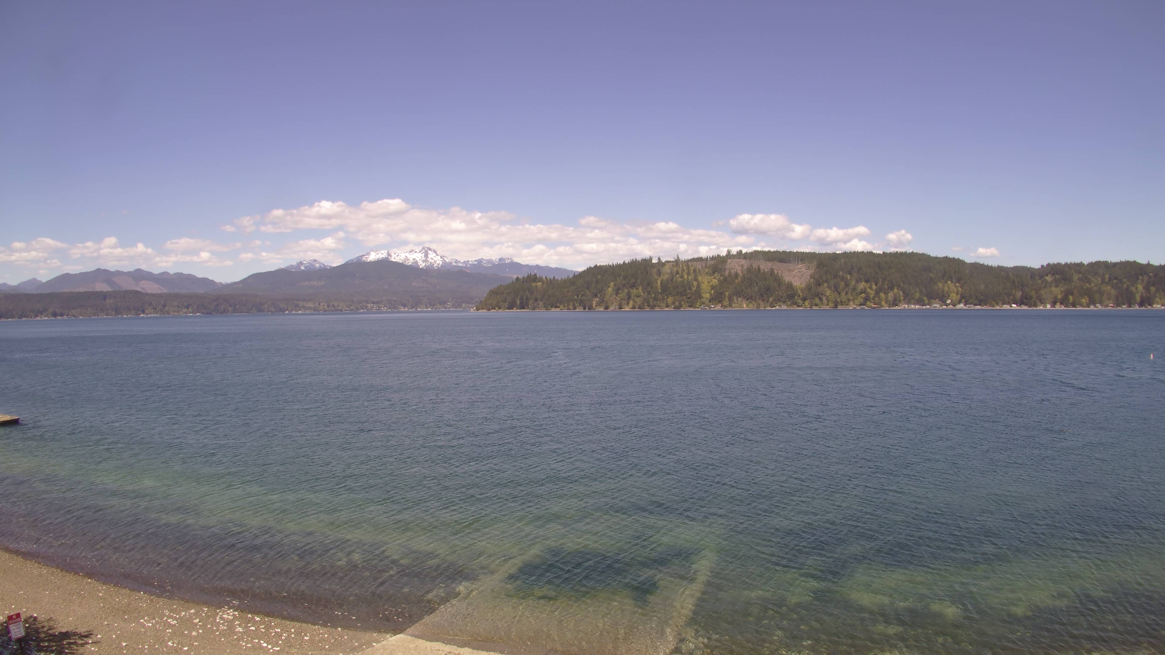 Elevation: 20 ft |
Queets on US 101 @ MP 151.7  Elevation: 40 ft |
Queets on US 101 @ MP 151.7  Elevation: 40 ft |
Lake Quinault, view looking west from Quinault, along South Shore Rd, 2 miles NE of US 101 @ MP 126 Elevation: 200 ft |
Point (not Port!) Grenville on SR 109 @ MP 36.5, 15 miles WNW of Humptulips on US 101 @ MP 109  Elevation: 130 ft |
Axford Prairie, 4 miles south of Humptulips, 1 mile SW of US 101 @ MP 106 Elevation: 170 ft |
State Camp Hill on US 101 @ MP 100.5  Elevation: 280 ft |
Cosmopolis Hill on US 101 @ MP 78  Elevation: 480 ft |
Mt Walker, US 101 @ MP 301.5  Elevation: 470 ft |
Oyster Bay Rd on US 101 @ MP 359  Elevation: 550 ft |
Rock Candy Mountain on SR-8 @ MP 16.1, west of Olympia  Elevation: 550 ft |
| Show telemetry | Hide telemetry | |||||||||||||||||||||
| |||||||||||||||||||||